Enlarge / Spy satellite images taken by the CIA during the Cold War have revealed hundreds of Roman forts across the Fertile Crescent. (credit: J. Casana et al./US Geological Survey)
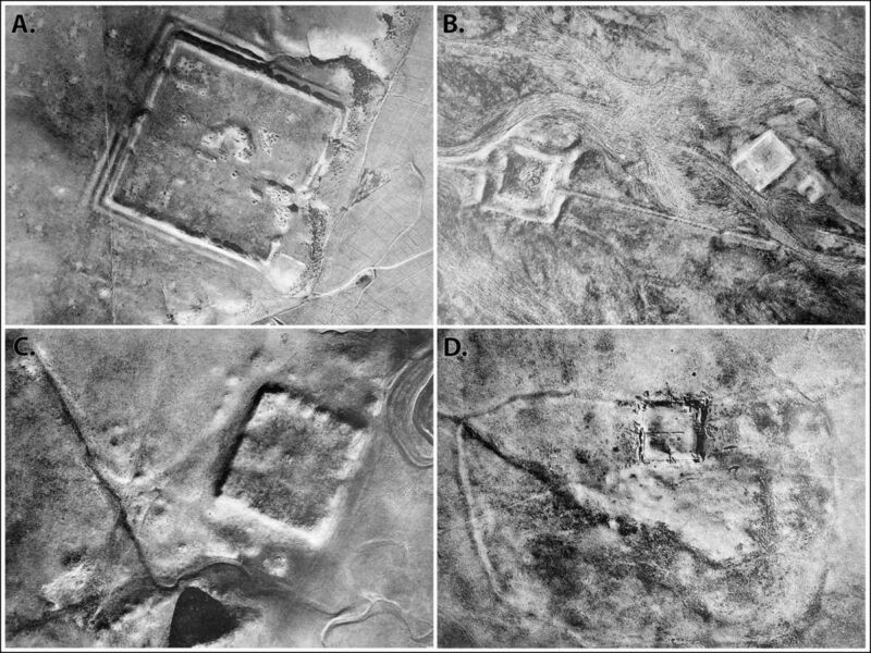
Back in the early days of aerial archaeology, a French Jesuit priest named Antoine Poidebard flew a biplane over the northern Fertile Crescent to conduct one of the first aerial surveys. He documented 116 ancient Roman forts spanning what is now western Syria to northwestern Iraq and concluded that they were constructed to secure the borders of the Roman Empire in that region.
Now, anthropologists from Dartmouth have analyzed declassified spy satellite imagery dating from the Cold War, identifying 396 Roman forts, according to a recent paper published in the journal Antiquity. And they have come to a different conclusion about the site distribution: the forts were constructed along trade routes to ensure the safe passage of people and goods.
Poidebard is a fascinating historical figure. A former World War I pilot, he later became a priest and joined the French Levant forces, helping pioneer the use of aerial photography as an archaeological surveying tool to discover and record sites of interest. (Previously, hot air balloons, scaffolds, or attaching cameras to kites were the primary means of gaining aerial context.) For his mapping missions, Poidebard clocked thousands of hours flying over Syria, as well as Algeria and Tunisia along the Mediterranean coast. He published his catalog of ancient Roman forts in his 1934 book, The Trace of Rome in the Syrian Desert, including some of the largest and best-known sites, including Sura, Resafa, and Ain Sinu.